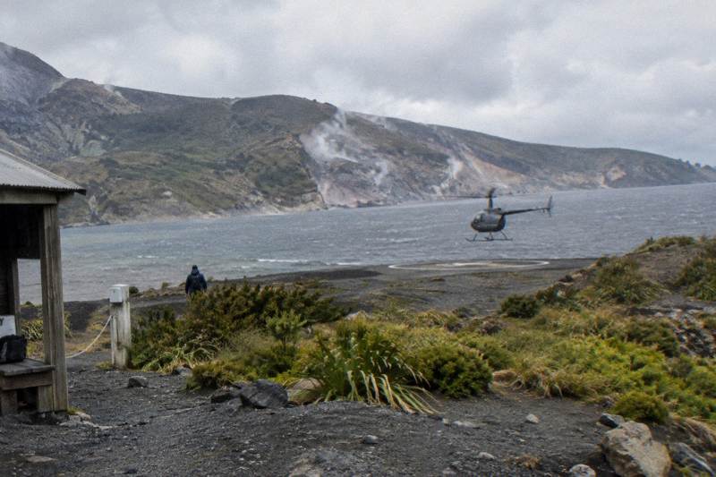
The 1886 Tarawera Eruption Seen From A Helicopter: What You Can Spot
The 1886 eruption of Mount Tarawera split the mountain open along a rift that scientists measure at 17 km, buried a village and destroyed the Pink and White Terraces. Flying over it today, the scar is still readable from the air.
Short answer
Mount Tarawera erupted on the night of 10 June 1886, opening a rift that GNS measures at 17 km across the mountain, Lake Rotomahana and into the Waimangu area, and killing more than 100 people. Helicopter flights from the Rotorua Lakefront cross lakes Okareka, Okataina and Tarawera, fly the operator's 8 km of rift over the mountain, and landings run from NZ$675 per person.
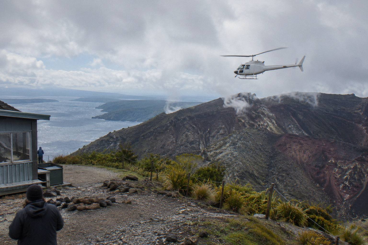
If the landing itself is the main draw, start with the Mount Tarawera helicopter landing guide; what follows here is the eruption story and how each flight reads it from the air. The two subjects cannot really be separated. A Tarawera flight without the 1886 narrative is a pretty ridge; with the narrative, every crater, lake and steam plume along the route has a cause and a date.
| Quick Fact | Detail |
|---|---|
| Eruption date | Night of 10 June 1886 |
| Rift length | 17 km (GNS Science); 8 km over the mountain in operator flight wording |
| Deaths | More than 100 people in villages near the mountain (GNS) |
| Summit height | 1,111 m, the Ruawahia dome the highest of three |
| Landing access | Guided tours or approved helicopter landings only |
| Flights depart | Volcanic Air, Lakefront, 1 Lakefront Drive, Rotorua |
| Check-in | 30 minutes prior for helicopters, 20 for floatplanes |
What Happened On The Night Of 10 June 1886
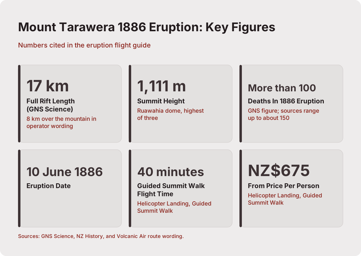
Mount Tarawera erupted on the night of 10 June 1886, splitting its three domes apart along a rift and raining ash and mud across the villages below. More than 100 people were killed, Te Wairoa was razed and all but covered, and the famous silica hot springs known as the Pink and White Terraces were buried. The exact hour and the exact toll differ between official sources, so the night itself is the only timing worth printing.
The mountain is not a single cone. It is a line of three rhyolite domes, Ruawahia, Tarawera and Wahanga, with Ruawahia the highest at 1,111 m. On that night in June the eruption opened vents along the whole crest, and the landscape of the central North Island changed in hours. NZ History records the rift as 17 km long, running across the mountain top, through Lake Rotomahana and into the Waimangu Valley area, which is the same span GNS Science describes in its Tarawera fact sheet. Te Wairoa village, now known as the Buried Village, was destroyed; Te Ara describes it as razed and all but covered with ash and mud.
The death toll is reported differently by source, from 108 up to about 150. The only figure every source supports is "more than 100 people", and that is the number to carry. For flyers, the relevance is simpler: nearly everything striking about the view from a Tarawera flight, the craters, the lakes, the valley, traces back to that single night. The deeper geological setting sits inside the Okataina volcanic centre that GeoNet monitors, of which Tarawera is the best known feature.
Understanding the date also explains why the mountain looks the way it does. The bare, reddish scarp of the summit is young terrain in geological terms, barely more than a century and a third old, which is why the craters remain so sharply defined from the air. Older eruptions in the Okataina centre built the domes themselves over thousands of years, but the 1886 event is the one that left the visible wound, and it is the one every pilot points out.
The Rift From The Air: 17 Km Of Scar Or 8 Km Of Craters
From a helicopter the eruption reads as a line of craters along the summit, and the numbers depend on who is measuring. GNS Science measures the full rift at 17 km, from the mountain top through Lake Rotomahana into the Waimangu area. Volcanic Air's own flight wording is 8 km of rift over the mountain itself, the segment its aircraft actually fly. Both are real figures describing different spans, never one combined fact.
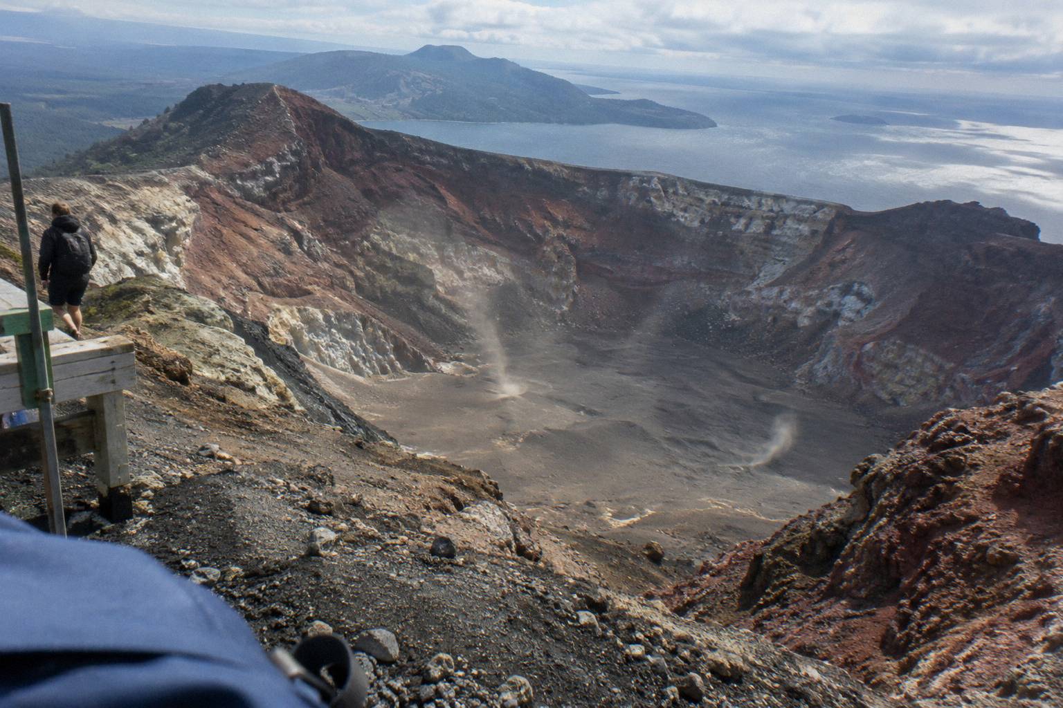
That distinction matters because a summit flight and a full rift story are not the same product. A flight that lands on Tarawera shows you the mountain's own portion, the raw craters blown open in 1886 stacked along the crest. A flight that continues south over Lake Rotomahana and the Waimangu Valley shows where the same rift continued downhill and birthed a new geothermal system: Waimangu's own material says its geothermal field is the direct result of the 10 June 1886 eruption.
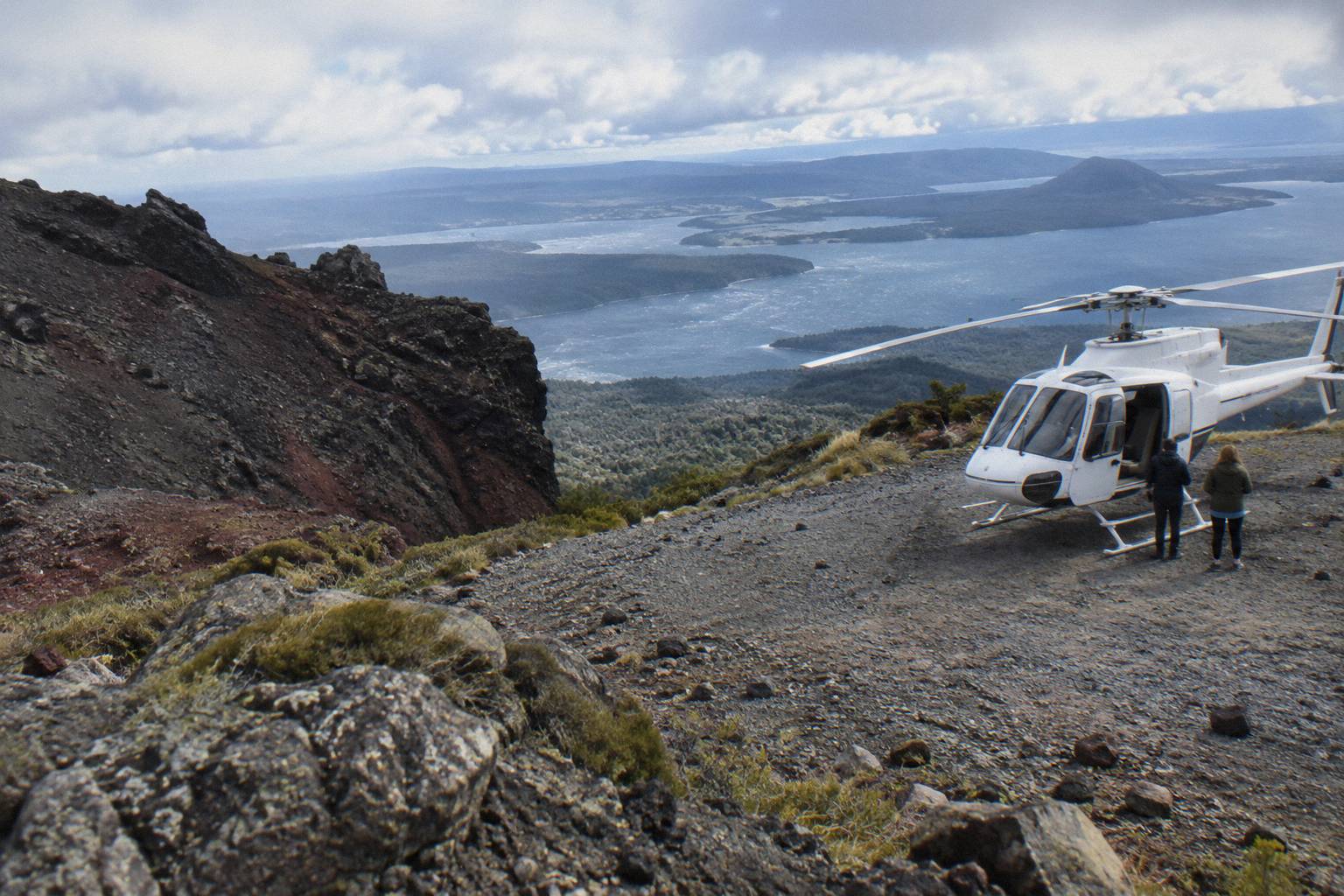
The Mt Tarawera Helicopter Tour with Volcano Landing is the trip built around this view: it carries a 4.9 rating from 43 reviews and follows the operator's description of flying the 8 km of rift and craters before attempting a summit landing. The Helicopter Landing, Guided Summit Walk covers similar air time, around 40 minutes total with a guided walk on the summit, from NZ$675 per person. For a flyover without a landing, the Scenic Floatplane, Tarawera And Waimangu runs about 30 minutes of flight and continues down the rift line toward Waimangu, from NZ$395 per person with a 4.9 rating from 28 reviews.
Two clarifications keep the numbers clean. First, the 17 km figure belongs to GNS and covers the whole eruption line; the 8 km figure belongs to the operator and covers the mountain segment flown. Second, the landing itself is never promised: operator wording is explicit that excursion landings are undertaken at your own risk and at the pilot's sole discretion, with duration and inclusions varying due to weather, volcanic activity and passenger loadings. The question whether you can land on Mount Tarawera by helicopter has a conditional answer, and the condition is always the pilot's call on the day.
When you are actually airborne, the rift reads in three movements. The crest section shows the craters as a chain of deep basins with sharp rims, close enough to pick out individual colours in the rock. The middle section, over Lake Rotomahana, swaps rock for water, the flooded basin where the terraces once sat on the shore. The final section, into the Waimangu area, is where steam starts appearing among the bush, the geothermal system the eruption switched on. A passenger who knows this sequence gets three distinct scenes in one flight; a passenger who does not sees a ridge, a lake and some steam.
What A Tarawera Flight Crosses Before The Mountain
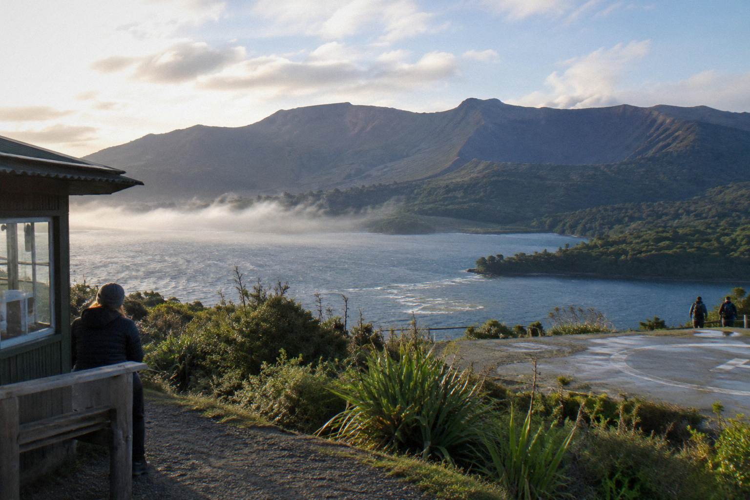
The approach is half the show. Operator route wording for the Tarawera landing flight crosses lakes Okareka, Okataina and Tarawera before the mountain, a chain of blue water and bush that sits inside the same volcanic landscape the 1886 eruption reshaped. Departures leave from the Lakefront at 1 Lakefront Drive, under 1 km from the Rotorua town centre, with helicopters taking off from the base and floatplanes from the lake itself.
That lake chain tells the region's story in reverse order. Lake Tarawera is the largest of the three and sits directly under the mountain; its scenic reserve includes the Rotomahana basin where the terraces stood, and DOC's page on the reserve describes the destruction and regrowth. Okareka and Okataina are quieter, forest-rimmed and closer to town. On clear days the flight up the chain gives a rising view that ends at the reddish scarp of the summit craters.
The full lakes experience is its own product. The 15-minute crater lakes flights, by helicopter or floatplane, orbit the cluster of crater lakes the operator counts as 12 distinct bodies, including Tikitapu (Blue Lake) and Rotokakahi (Green Lake), plus Mokoia Island, described by the operator as a native bird sanctuary. If the eruption narrative is the reason for flying, the Tarawera flights are the match; if the lakes are the draw, the Rotorua scenic flights guide breaks that family down.
| Flight | Aircraft | Rift coverage | Landing | From price |
|---|---|---|---|---|
| Helicopter Volcano Landing | Helicopter | 8 km operator wording over the mountain | Mt Tarawera summit, pilot's discretion | Price on the booking page |
| Helicopter Landing, Guided Summit Walk | Helicopter | Mountain overflight, about 40 minutes total | Summit with guided walk | NZ$675 per person |
| Scenic Floatplane, Tarawera And Waimangu | Floatplane | Mountain and Waimangu Valley flyover | No landing (flyover) | NZ$395 per person |
| Crater Lakes By Helicopter, 15 Minutes | Helicopter | Lakes circuit, not the rift | No landing (flyover) | Price on the booking page |
| Geothermal Park Landing, 3 Hours | Helicopter | Tarawera summit plus Orakei Korako | Both sites | NZ$1,490 per person |
Lake Rotomahana And The Pink And White Terraces
The terraces were silica hot springs on the shore of Lake Rotomahana, buried by the 1886 eruption. NZ History records them as the famous Pink and White Terraces; GNS notes the White Terraces were largely destroyed and that remnants of the Pink Terraces may lie at the bottom of the enlarged lake. From the air, what you see is not the terraces but the lake that swallowed their world, grown far beyond its pre-eruption size.
How much it grew depends on the source. DOC's material on the Lake Tarawera Scenic Reserve says the lake is now twenty times its original size; GNS says five times. Because the official sources disagree, no multiple belongs on the page. What is safe: the basin you fly over is a different body of water than the one that existed before the eruption, and the terraces' exact resting place remains a research question, not a sightseeing stop.
Flights that include Rotomahana in the view frame this best. The floatplane trips over Tarawera and Waimangu pass the lake on the rift line south of the mountain, and the helicopter trips that continue past the summit toward Waimangu do the same. The Pink and White Terraces helicopter guide covers the sighting question in detail, including why no operator can promise a glimpse of anything beneath the water.
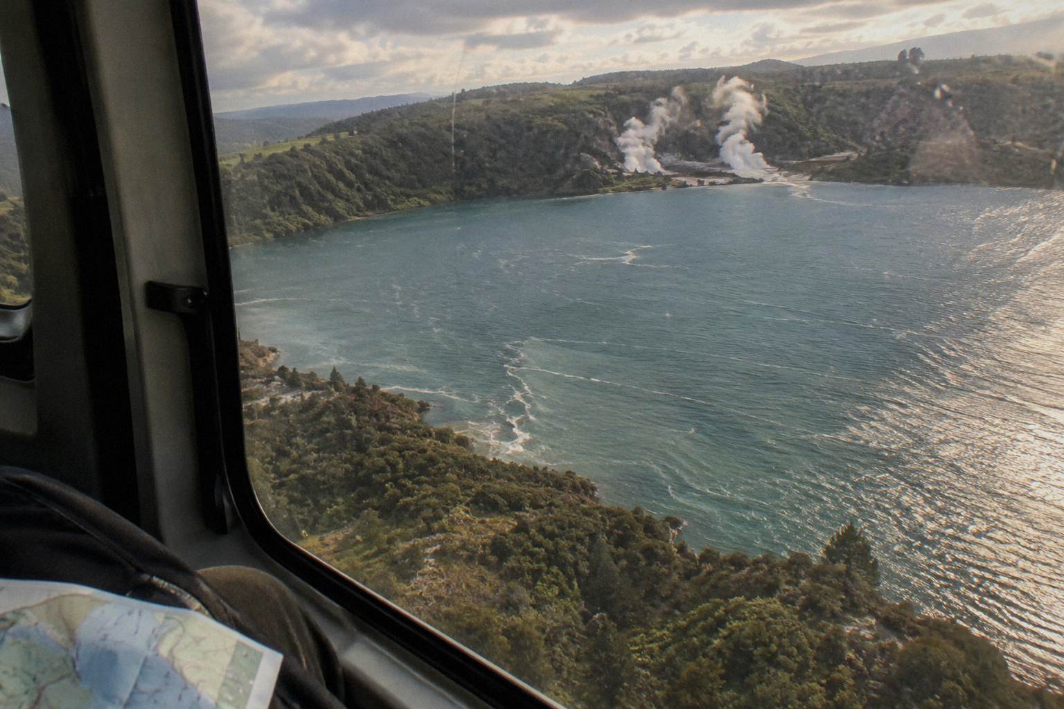
For most readers the practical takeaway is a framing one: book the flight for the landscape the eruption created, not for a specific relic. The terraces story is the emotional hook, but the visible evidence from the air is the rift, the craters, the oversized lake and the steaming valley beyond it. Passengers who arrive expecting a lost wonder under glass sometimes leave disappointed; passengers who arrive expecting to read a catastrophe in the terrain rarely do.
The colour of Rotomahana itself is part of the evidence. Seen from altitude, the water sits in a rimmed basin with steep bush-covered walls, clearly a hole rather than a river valley, and clearly young. Chances are the pilot will narrate the terraces as the aircraft tracks the shoreline; the operator's route descriptions make the lake a fixed waypoint on the Waimangu-bound trips. Listen for the distinction between what is known, the eruption and the burial, and what is inferred, the exact fate of the Pink Terraces' remnants.
Te Wairoa, The Buried Village Below The Mountain
Te Wairoa was the village that sheltered visitors on their way to the terraces in the years before the eruption, and it was razed and largely buried by ash and mud on the eruption night. It survives today as the Buried Village at 1180 Tarawera Road, a museum and excavated site on the road between Rotorua and Lake Tarawera, close enough to the Lakefront base that a flight and a ground visit can share a day.
From the air, the Buried Village sits in the green corridor below the mountain's southern flank, and pilots pointing out the 1886 story typically sweep the area where the village, the lake outlet and the old terraces road all sit. On the ground, the site adds the human scale that a flyover cannot: the excavation, the accounts of the night, and the recovery that followed. NZ History's eruption record names Te Wairoa explicitly as "The Buried Village", and Te Ara's account covers the same destruction. The full index of guides sits on Rotorua Helicopter Tours.
Combining the two works well as a day plan. Morning flights more often get the calmer air the operator's own FAQ points to, with softer light for photographs; an afternoon at the village, about 25 minutes' drive from the city centre on Tarawera Road, fills the rest. The one day Rotorua itinerary with a flight sequences exactly that kind of pairing, and the Lake Tarawera helicopter guide covers the ground side of the area.
| Eruption fact, sourced | Where the flight shows it |
|---|---|
| Rift, 17 km, GNS measurement | The line from the summit craters over Rotomahana toward Waimangu |
| More than 100 killed, GNS | The Buried Village site and the village corridor below the mountain |
| Te Wairoa razed and covered, Te Ara | The green basin on the southern flank, best narrated by the pilot |
| Terraces buried, NZ History | The enlarged Lake Rotomahana basin on the rift line |
| Waimangu system born of the eruption, park account | The steaming valley at the southern end of the route |
Which Flight Best Tells The Eruption Story
For the eruption narrative specifically, the Mt Tarawera Helicopter Tour with Volcano Landing is the closest match: it flies the operator's 8 km of rift and craters and aims to land on the summit where the eruption began. The One-Hour Volcanic Adventure adds air time around the wider volcanic landscape, and the floatplane Tarawera and Waimangu trips follow the rift downhill to the valley it created, at lower cost and without a landing.
The choice reduces to three questions. Do you want to stand on the mountain? That points to a helicopter landing trip, with the standing caveat that the landing is always the pilot's decision on the day. Do you want the whole rift line from summit to valley? That points to the floatplane trips that continue to Waimangu, or the helicopter trips with longer routing. Is the budget the constraint? The 30-minute scenic floatplane from NZ$395 per person covers Tarawera and Waimangu and keeps the eruption story intact.
The Geothermal Park Landing, 3 Hours trip is the maximal option: Tarawera summit plus a landing at Orakei Korako, from NZ$1,490 per person, roughly three hours all in. The Dual Landing Thermal Explorer covers similar territory. If you are weighing the two formats against each other rather than the routes, the Rotorua helicopter versus floatplane guide sets out the differences, including the lake take-off that makes the floatplane experience distinct.
Practicalities: Check-in, Weights, Weather And Seasons
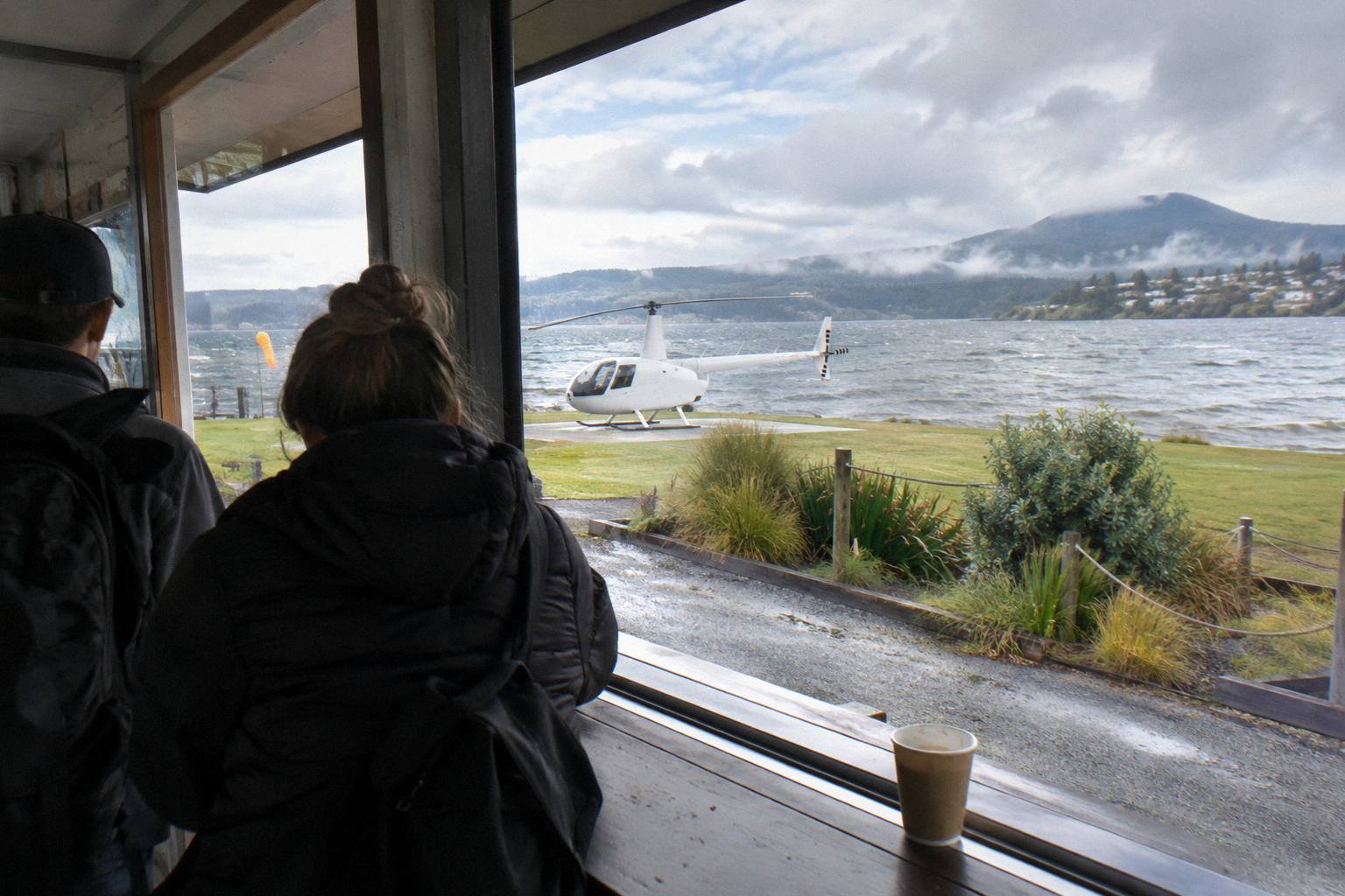
Plan on checking in at the Lakefront office 30 minutes before a helicopter flight or 20 minutes before a floatplane for a full safety briefing. Declare individual weights at booking, since passengers are weighed on arrival and deviations can mean a reschedule, a surcharge or cancellation. All flights operate subject to suitable weather; if the operator cancels for weather or volcanic activity, the terms promise a full refund or a reschedule.
The weight rules are specific. Over 110 kg a surcharge may apply at the operator's sole discretion, and over 135 kg as weighed the booking requires two adult fares. Children of all ages are welcome, with under 2s on a lap and child rates for 2 to 11. Bring a camera, sunglasses and a jacket, and closed-toe footwear for flights with landings, per the operator's FAQ.
Season matters less than the day. Rotorua's driest, warmest window runs from late spring in October to early autumn in April, and rainfall normals peak in July at 137.4 mm against November's 86.8 mm, but flights run all year during daylight hours and the operator's FAQ notes mornings often give the calmest conditions. The booking terms across the Tarawera trips carry free cancellation up to 24 hours in advance, which matters when weather is the deciding variable. The Rotorua helicopter weather guide covers the cancellation mechanics, and what happens when a flight is cancelled for weather walks through the refund path.
| Planning item | Detail |
|---|---|
| Check-in | Lakefront office, 30 min prior helicopters, 20 min floatplanes |
| Weight | Declared at booking, weighed on arrival; surcharge possible over 110 kg |
| Children | All ages; under 2 on lap, rates for 2 to 11 |
| Cancellation terms | Free cancellation up to 24 hours in advance on the booking terms |
| Operator weather cancellation | Reschedule or full refund |
| Best window | October to April for drier weather; mornings often calmest |
Mistakes That Trip Up Eruption-Story Flights
The common errors: booking a lakes-only flight and expecting the rift, assuming the summit landing is guaranteed, quoting one rift length as if GNS and the operator measured the same thing, and planning a tight same-day schedule with no slack for weather. Each is avoidable. Match the route to the story you want, treat the landing as a bonus the pilot may allow, and leave the afternoon free in case the morning flight is rescheduled.
The route mismatch is the most frequent. The 15-minute crater lakes flights are superb value but they orbit the lakes, not the mountain; the eruption story needs a trip with Tarawera in the route name. The second error is schedule compression. Because every flight is weather dependent, a same-day departure, a wedding, or a 2 pm drive to Auckland all turn a routine reschedule into a lost booking; the free cancellation window of 24 hours helps on your side, but the operator cannot manufacture calm air.
The third is expecting to see the terraces. GNS says remnants of the Pink Terraces may lie at the bottom of Lake Rotomahana; may, and bottom, are the operative words. Book for the landscape and the history you can read in it, and the flight delivers. The fourth is footwear and clothing: summit landings are on volcanic ground, and the operator asks for closed-toe shoes and a jacket regardless of the Rotorua temperature at the lakefront.
A fifth mistake is quieter: not asking the pilot. The trips are narrated, and the 1886 story is the operator's home ground, they have been flying in this region since 1992 on their own account. Passengers who arrive knowing the two rift numbers and the terrace question tend to get richer commentary, because the questions give the pilot something to aim at rather than a generic script. Read the facts above on the drive out, and the flight stops being scenery and becomes a guided reading of a single night.
Common Questions About The Tarawera Eruption Flight
What Happened On The Night Of 10 June 1886?
Mount Tarawera erupted along a rift GNS measures at 17 km, killing more than 100 people, destroying Te Wairoa and burying the Pink and White Terraces. Exact timing and the exact toll differ between official sources, so the night of 10 June 1886 is the settled fact.
Can A Helicopter Land On The 1886 Eruption Site?
Yes, subject to conditions. Volcanic Air holds approved landing access to the Tarawera summit, and its terms state that excursion landings are at the passenger's own risk and the pilot's sole discretion, with weather and volcanic activity deciding on the day.
How Long Is The Rift You See From A Helicopter?
The full 1886 rift is 17 km long on GNS Science's measurement, running through Lake Rotomahana into the Waimangu area. The operator's flight wording is 8 km of rift over the mountain, the segment its aircraft fly. The two figures describe different spans.
Which Flight Shows The Most Of The Eruption Landscape?
The floatplane trips over Tarawera and Waimangu follow the rift line from the summit down to the valley the eruption created. The helicopter landing trips focus on the summit craters, and the Geothermal Park Landing adds Orakei Korako over roughly three hours.
Can You Still See The Pink And White Terraces From The Air?
No flight shows them. GNS notes the White Terraces were largely destroyed and remnants of the Pink Terraces may lie at the bottom of Lake Rotomahana. What a flight shows is the enlarged lake basin the eruption left behind.
How Much Does A Tarawera Eruption Flight Cost?
From-prices on the booking pages: NZ$395 per person for the 30-minute scenic floatplane over Tarawera and Waimangu, NZ$675 per person for the helicopter landing with guided summit walk, and NZ$1,490 per person for the three-hour geothermal park landing. All amounts are New Zealand dollars.