What Can You See On A Helicopter Flight Over Rotorua?
A route-by-route breakdown of the lakes, volcanoes, geothermal valleys and island views visible from Rotorua's helicopter and floatplane scenic flights, with per-trip comparisons.
| Quick Facts | |
|---|---|
| Lakes named on flights | Rotoiti, Okataina, Tarawera, Okareka, Rotomahana, Rotokakahi, Tikitapu |
| Iconic volcano | Mount Tarawera, summit 1,111 m, erupted 10 June 1886 |
| Distant highlight | Whakaari / White Island, about 48 km off the coast of Whakatane |
| Geothermal parks overflown or landed at | Orakei Korako, Waimangu Volcanic Valley |
| Departure point | Lakefront, 1 Lakefront Drive, Rotorua |
| Typical sightseeing flight length | 15 minutes to 3 hours depending on the trip |
Rotorua sits inside one of the most compact volcanic landscapes anywhere a scenic flight operates. Inside twenty minutes of wheels-up you can be over crater lakes that fill old eruption vents, and inside an hour over a rift that tore a mountain open in 1886. The question is rarely whether there is something to see from a helicopter here. It is which of the thirteen flights on the local roster covers the scenery you actually care about, because a 15-minute city loop and a 3-hour dual-landing expedition share a departure pier and almost nothing else.
The operator, Volcanic Air, has been flying in the region since 1992 and describes itself as a CAA-certified air operator. Every flight leaves from the Lakefront at 1 Lakefront Drive, under a kilometre from the town centre, with helicopters checking in 30 minutes before departure and floatplanes 20 minutes. What follows is a route-by-route account of the named places each family of flights crosses, drawn from the operator's own route descriptions and from geological sources, with no promises about what any given day will show. Weather, volcanic activity and the pilot's judgement decide what a flight sees and whether it lands.
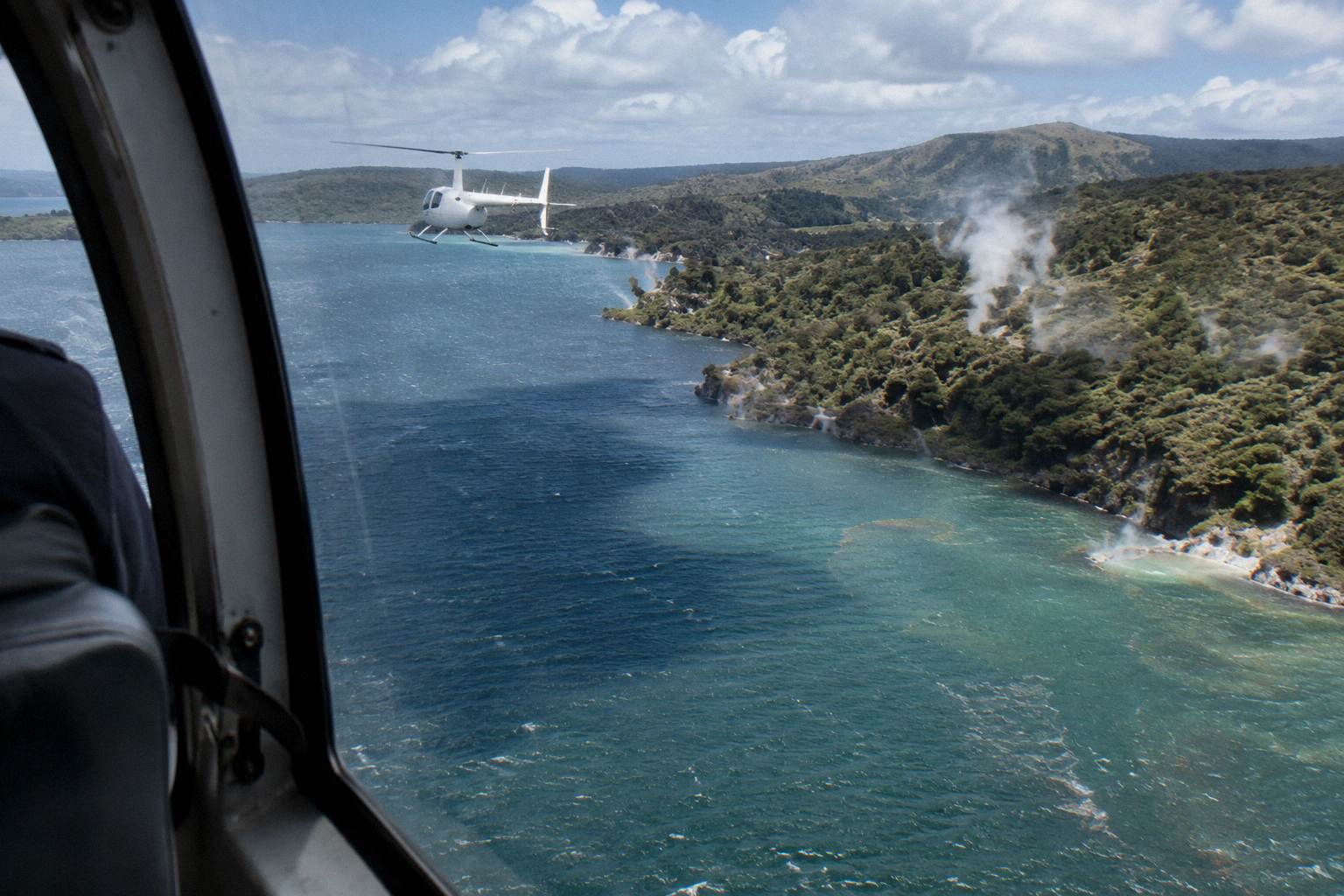
A helicopter flight over Rotorua shows you the crater lakes just south of the city, Mount Tarawera's summit domes and 8 km of rift per the operator's flight wording, the geothermal colors of Waimangu Volcanic Valley, and Lake Rotomahana, where the Pink and White Terraces once stood. On the longest trips you can also see the steam of Whakaari / White Island about 48 km offshore, while short flights stay over the lakes.
The honest answer is layered, because the roster spans a wide range. The 15-Minute Crater Lakes Flight by Helicopter from Rotorua, the Crater Lakes By Helicopter trip, stays close to home and focuses on the lake country. The Mt. Tarawera Volcano Scenic Floatplane Tour and its cousins push south to the mountain. The Helicopter Volcano Landing and the One-Hour Volcanic Adventure add a summit landing. At the far end, the Volcanic Extremes helicopter trip runs an hour and 45 minutes and links Tarawera with a Whakaari flyover.
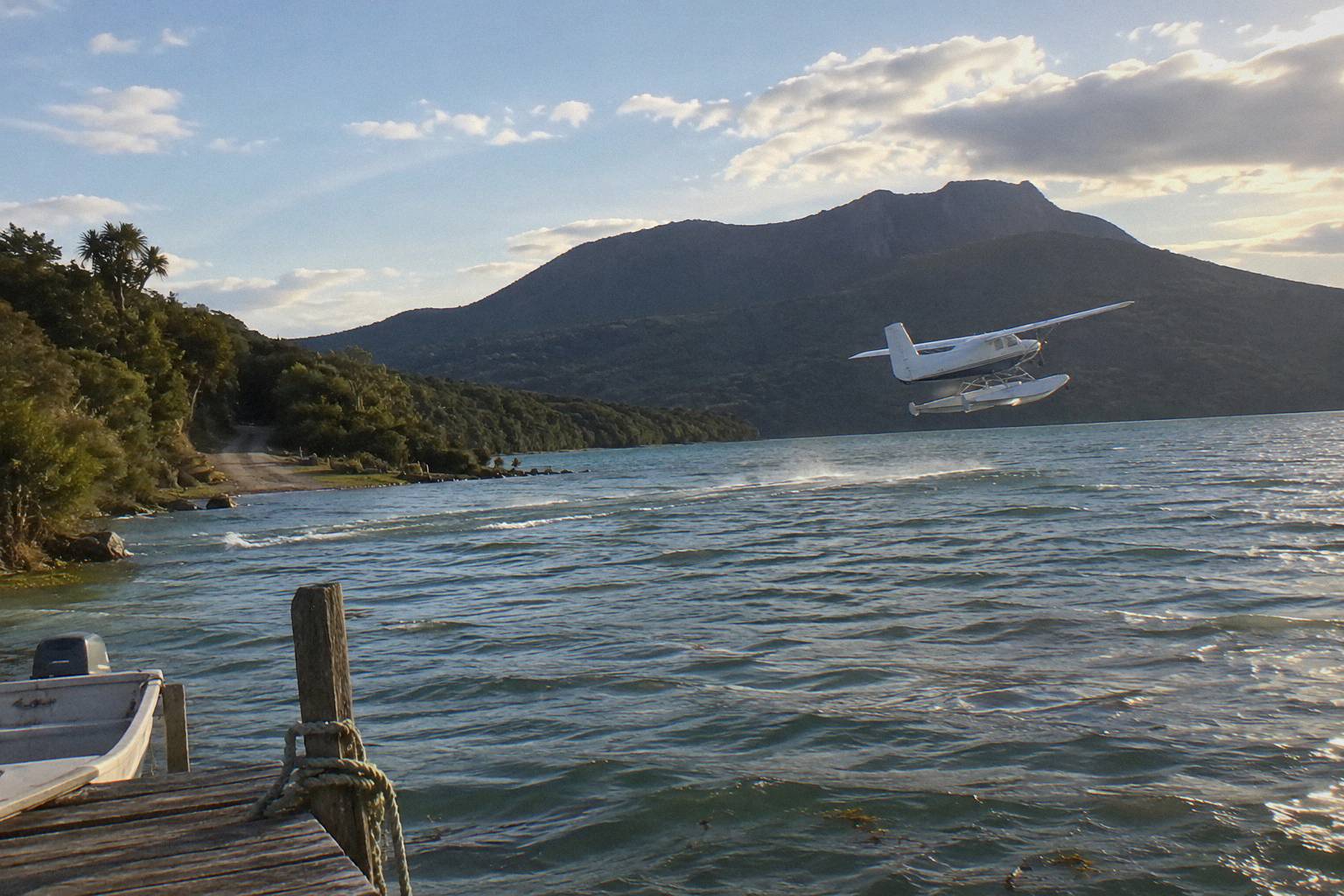
Aircraft type changes the flavour more than the list of sights. Floatplanes take off from Lake Rotorua itself, off the lakefront pier, and land on water: the Floatplane, Orakei Korako Landing trip touches down on the Waikato River beside the geothermal park. Helicopters give the hovering, door-level views over craters and the option of putting you on the ground at the summit. For a fuller comparison of the two formats, the rotorua scenic flights overview breaks down every route on the roster side by side.
The Crater Lakes South Of The City
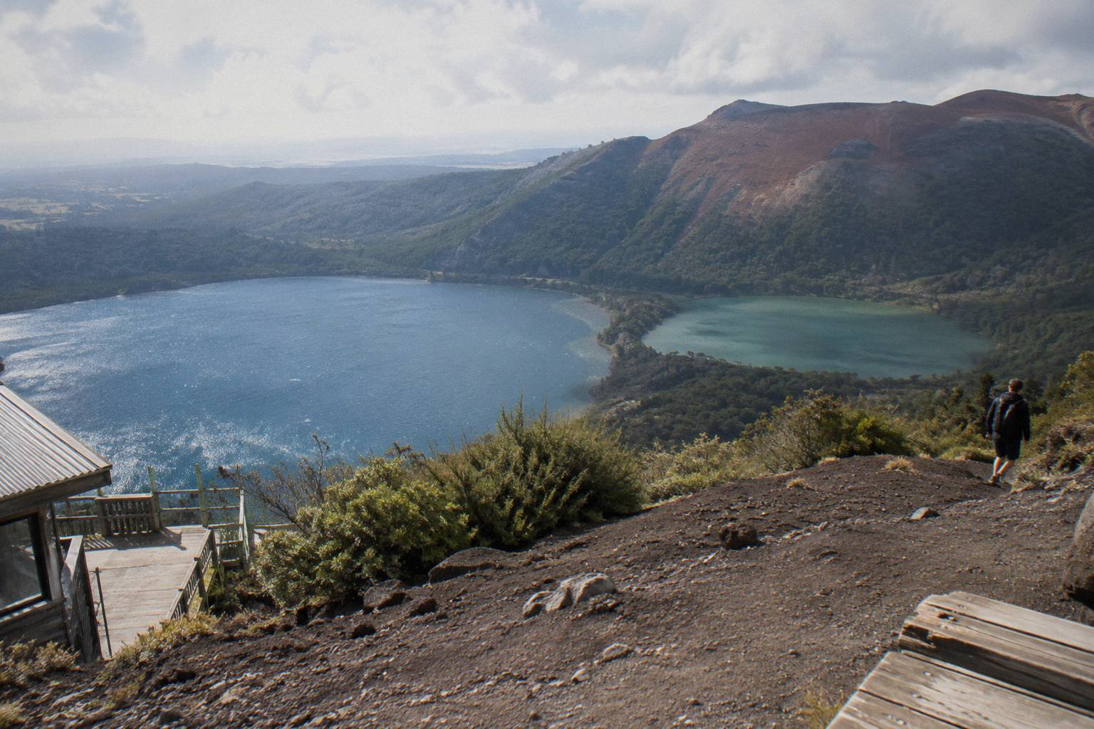
The lakes visible on the short flights are Rotoiti, Okataina, Tarawera, Okareka, Rotomahana, Rotokakahi (Green Lake) and Tikitapu (Blue Lake), and the operator's crater lakes page also speaks of views of 12 distinct crater lakes. Floatplane versions of the route climb around Mokoia Island, described by the operator as a native bird sanctuary, with Sulphur Bay and the city in view on departure. No flight promises every lake on every day; the route description is the plan, not a guarantee.
The 15-minute flights exist because the lake district starts almost immediately. Rotokakahi and Tikitapu sit close together, one deep green, one deep blue, and they are among the first distinctive features south of the city. Lake Tarawera, the largest of the group, spreads beneath the mountain of the same name, and Lake Rotomahana beyond it fills the basin scarred by the 1886 eruption. The operator's own description of the crater lakes route names these lakes in order, which is why the short flights punch above their length: you are over genuinely dramatic water within a few minutes of leaving the Lakefront.
The related tour on this page, the Crater Lakes By Helicopter trip, is the 15-minute helicopter version of exactly this route. Like the other roster trips it carries free cancellation up to 24 hours in advance. If the lake district is the part of the Rotorua landscape you most want to see, it is the fastest and cheapest way to be directly above it rather than looking at it from a shoreline. The floatplane twin, Crater Lakes By Floatplane, covers comparable territory with a takeoff from the water.
Which Lake Views Justify Which Trip
| Trip | Lakes crossed per route description | Format |
|---|---|---|
| Crater Lakes By Helicopter, 15 Minutes | Crater lake district south of the city | Helicopter |
| Crater Lakes By Floatplane, 15 Minutes | Crater lake district, Mokoia Island climb | Floatplane |
| Helicopter Landing, Guided Summit Walk | Okareka, Okataina, Tarawera en route to the mountain | Helicopter |
| Floatplane, Waimangu Included | Tarawera and Waimangu Valley flyover | Floatplane |
| Dual Landing Thermal Explorer | Tarawera lakes, then Orakei Korako on the Waikato River | Helicopter |
Mokoia Island deserves its own mention because it anchors the departure end of every floatplane route. The operator describes climbing around the island, a native bird sanctuary in the middle of Lake Rotorua, before turning south. On the return leg the city itself, Sulphur Bay and the lakefront come back into frame, which is a quiet bonus of flying from a base this central: the town you are staying in is part of the scenery on both ends of the flight.
Mount Tarawera And The 1886 Rift
From the air, Mount Tarawera shows three summit domes, Ruawahia, Tarawera and Wahanga, with the eruption rift running across the mountain top: GNS describes a 17 km rift extending through Lake Rotomahana into the Waimangu area, while the operator's flight wording speaks of flying over the mountain's 8 km of rift and craters. The summit stands 1,111 m, and helicopter trips can land on it, always at the pilot's sole discretion.
The eruption on the night of 10 June 1886 is the single event that shaped everything the southern routes fly over. More than 100 people were killed in villages near the mountain, Te Wairoa was razed and all but covered with ash and mud, and the famous silica hot springs known as the Pink and White Terraces were buried. GNS notes that the White Terraces were largely destroyed and that remnants of the Pink Terraces may lie at the bottom of Lake Rotomahana, which is why passengers on Tarawera routes often look for the lake as much as the mountain: it is a gravesite of the terraces, not just scenery. The NZ History account of the eruption and the GNS Tarawera fact sheet are the primary sources for those figures.
What the rift looks like from a window is a long, raw gash of red and grey scoria across the domes, vegetated at the edges, bare along the line where the ground opened. The operator's landing tour, the Helicopter Volcano Landing trip, describes flying the rift and craters, then landing on the summit for a 15 minute guided walk when conditions and the pilot allow. The Helicopter Landing, Guided Summit Walk trip does the same in a 40-minute total format, from NZ$675 per person, and the One-Hour Volcanic Adventure stretches the same idea across more air time. Landings are never guaranteed: the operator's terms are explicit that excursion landings are undertaken at your own risk and at the pilot's sole discretion, and that duration and inclusions vary with weather, volcanic activity and passenger loadings.
Access itself is part of the story. Independent summit access is not permitted; the mountain is reached through authorised guided tours or approved helicopter landings, and the Ruawahia 2B Trust, which governs Mount Tarawera, reinvests most tourism concession revenue in conservation alongside Ngati Rangitihi as kaitiaki of the maunga. That context is worth knowing before you fly: the landing is a concession, not a right, and the flight over the rift is the only way most visitors ever see the full length of it. For more on that decision, whether a Tarawera helicopter landing is worth it works through the trade-offs.
Geothermal Valleys, Orakei Korako And Waimangu
South and west of Tarawera the flights cross the geothermal landscape: Waimangu Volcanic Valley, formed along the line of the 1886 rift, and on the dual-landing trips, Orakei Korako on the Waikato River, where the operator's description has the pilot touching down on the winding river at the Hidden Valley. The park's geothermal field is only accessible by boat from its visitor centre, with boats leaving on request rather than a timetable.
Waimangu is the youngest of the valley's geothermal systems; its own pages attribute the system directly to the 10 June 1886 eruption, and it sits about 25 minutes drive from the city centre. From the air the valley reads as a corridor of steaming ground and pale crater water running away from the mountain toward Lake Rotomahana. The Scenic Floatplane, Tarawera And Waimangu trip crosses both in a 30-minute flight, from NZ$395 per person, with a rating of 4.9 from 28 reviews on its live listing, and it is a flyover rather than a mountain landing. The Floatplane, Waimangu Included trip adds a White Island flyover to the same Tarawera and Waimangu scenery, 2 hours in total, from NZ$1,230 per person.
Orakei Korako is a different proposition because the flights that go there land. The park sits between Rotorua and Taupo on the Waikato River at Lake Ohakuri, and the operator's floatplane description has the aircraft touching down on the river itself before the short ferry crossing to the geothermal field. The park describes up to 23 active geysers and Ruatapu Cave, over 36 m deep, running down to the Pool of Mirrors. The Dual Landing Thermal Explorer helicopter trip pairs a Tarawera summit landing with Orakei Korako in one outing, and the Geothermal Park Landing, 3 Hours trip does the same combination across three hours, from NZ$1,490 per person.
Those dual-landing trips are the ceiling of what a single booking can show you: the city lakes on departure, the Tarawera rift, and a walk through a geothermal field on the Waikato, all in one morning or afternoon. The Orakei Korako helicopter combination guide covers that pairing in detail, including what the ferry-access-only field means for timing.
Whakaari / White Island From The Air
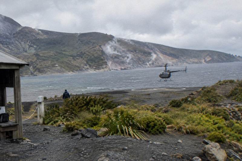
On the longest flights the route extends to Whakaari / White Island, about 48 km off the coast of Whakatane, described by the operator as New Zealand's only permanently active offshore volcano. Landings on the island are suspended: official New Zealand guidance states there are currently no boat tours to, or helicopter flights that land on, the island. The Volcanic Extremes helicopter trip flies over Whakaari and lands at Tarawera across 1 hour 45 minutes.
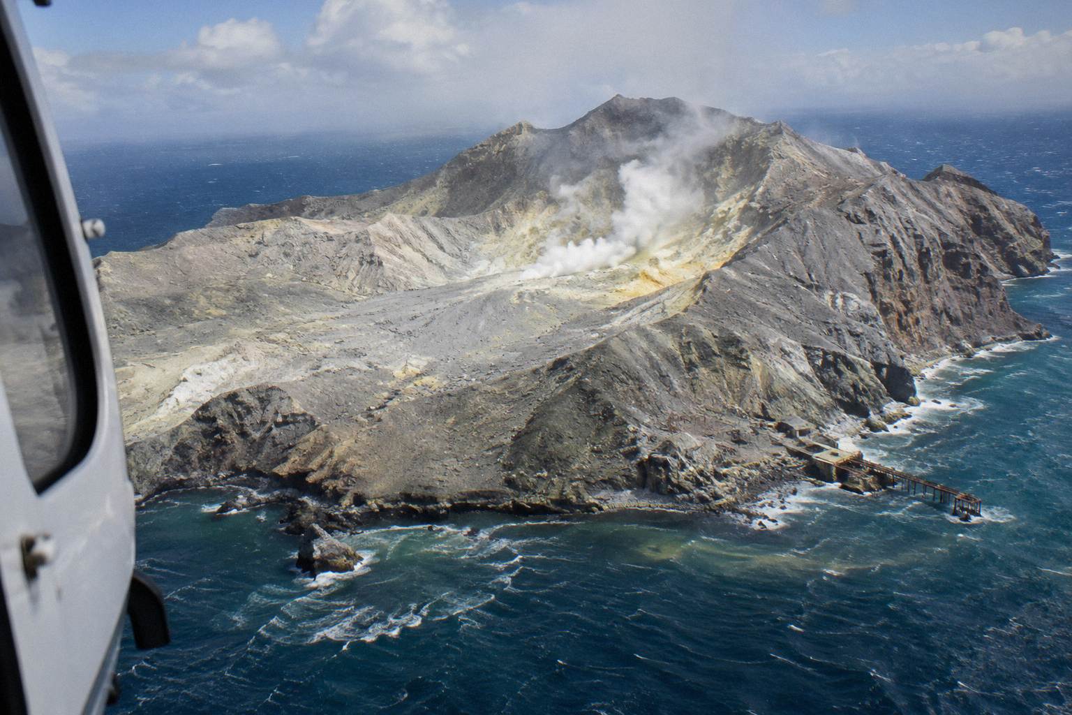
Whakaari erupted on 9 December 2019, an event that killed 22 people and injured 25 others. What exists today from Rotorua is the flyover: floatplane trips such as the Floatplane, White Island And Tarawera and the Floatplane, Waimangu Included route carry the island in their route descriptions, and the Volcanic Extremes helicopter trip links the offshore overflight with a Tarawera summit landing. From the window the island reads as a sulphur-stained cone with a collapsed crater wall, and the operator's marketing leans on the permanent activity, though volcanic conditions change and no flight promises visible steam or eruptive behaviour on any given day. Live status is tracked by GeoNet's Whakaari page, which is the reference to check rather than any frozen description, including this one.
| Trip | Whakaari in route | Format | Total time |
|---|---|---|---|
| Volcanic Extremes | Flyover, plus Tarawera landing | Helicopter | 1 hour 45 minutes |
| Floatplane, White Island And Tarawera | Flyover only | Floatplane | Not published |
| Floatplane, Waimangu Included | Flyover with Waimangu included | Floatplane | 2 hours |
The practical point for a sightseeing buyer is distance. Whakaari is the farthest object on any Rotorua route, which is why the trips that include it are also the longest and the dearest per person. If the island is the thing you want to see, choose a trip whose route description names it, and check the Whakaari flyover versus landing question before assuming anything about setting down there.
The City, The Lakefront And What Departure Looks Like
Every flight begins and ends over the city itself: the Lakefront base at 1 Lakefront Drive, Sulphur Bay with its steam at the lake edge, and the sprawl of Lake Rotorua with Mokoia Island in the middle. Floatplanes take off from the lake off the pier; helicopters lift from the Lakefront pad. The town is under 1 km from the base, so the urban and lakeshore scenery is genuinely part of the route, not just a taxi leg.
It is easy to treat the departure as dead time, but Rotorua's setting makes it scenery. Sulphur Bay sits at the lakefront's edge and carries geothermal steam into the frame almost from rotation. The city is compact enough that within seconds of lift-off you have the whole grid of it, then the lake opening out, then Mokoia Island on the floatplane climbs. On the return, the same features reappear in reverse, which means even the shortest 15-minute trips deliver two passes over the urban shoreline.
Weather is the wildcard across all of it, and Rotorua's climate has a shape: the driest and warmest months run from late spring in October to early autumn in April according to Rotorua's official tourism guidance, and monthly rainfall norms range from 86.8 mm in November to 137.4 mm in July. The operator's FAQ notes mornings often give the calmest weather and smoothest flying, with no hard and fast answer, and that flights which cannot go ahead due to weather are rescheduled or fully refunded. Nothing in the scenery is promised on a given day; the route is the intent.
Mistakes To Avoid When Picking A Flight For The Views
The most common mistake is buying a short lake flight and expecting Tarawera, or buying a Tarawera flyover and expecting a landing; the route descriptions are specific, and the differences are real. The second is assuming the aircraft type determines the scenery, when the route does. The third is treating a landing, at Tarawera or anywhere on the roster, as part of the deal, when every landing sits at the pilot's sole discretion and depends on weather and volcanic activity.
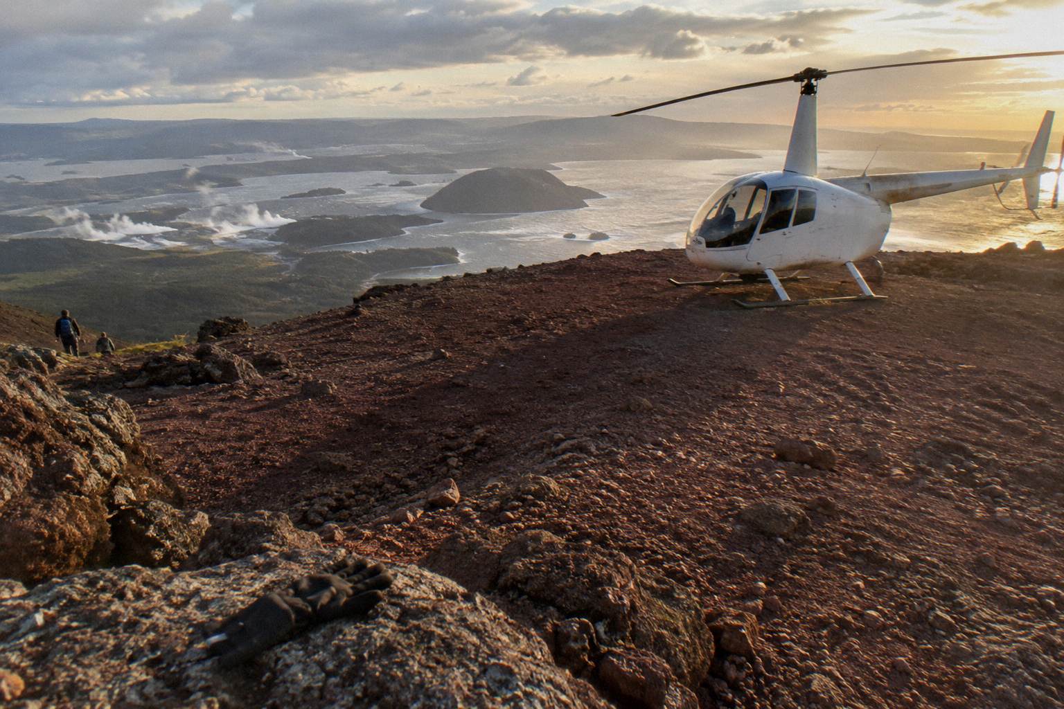
Match the trip to the single sight you care about most. If it is the lakes, the 15-minute crater lake flights are purpose-built for them. If it is the 1886 rift, you need a Tarawera route, and if standing on the summit matters, you need a landing trip and the acceptance that the pilot may decline. If it is geothermal ground-level scenery, Orakei Korako landing trips are the ones that put you in a park. If it is Whakaari, only the longest routes reach it, and only as a flyover while landings remain suspended.
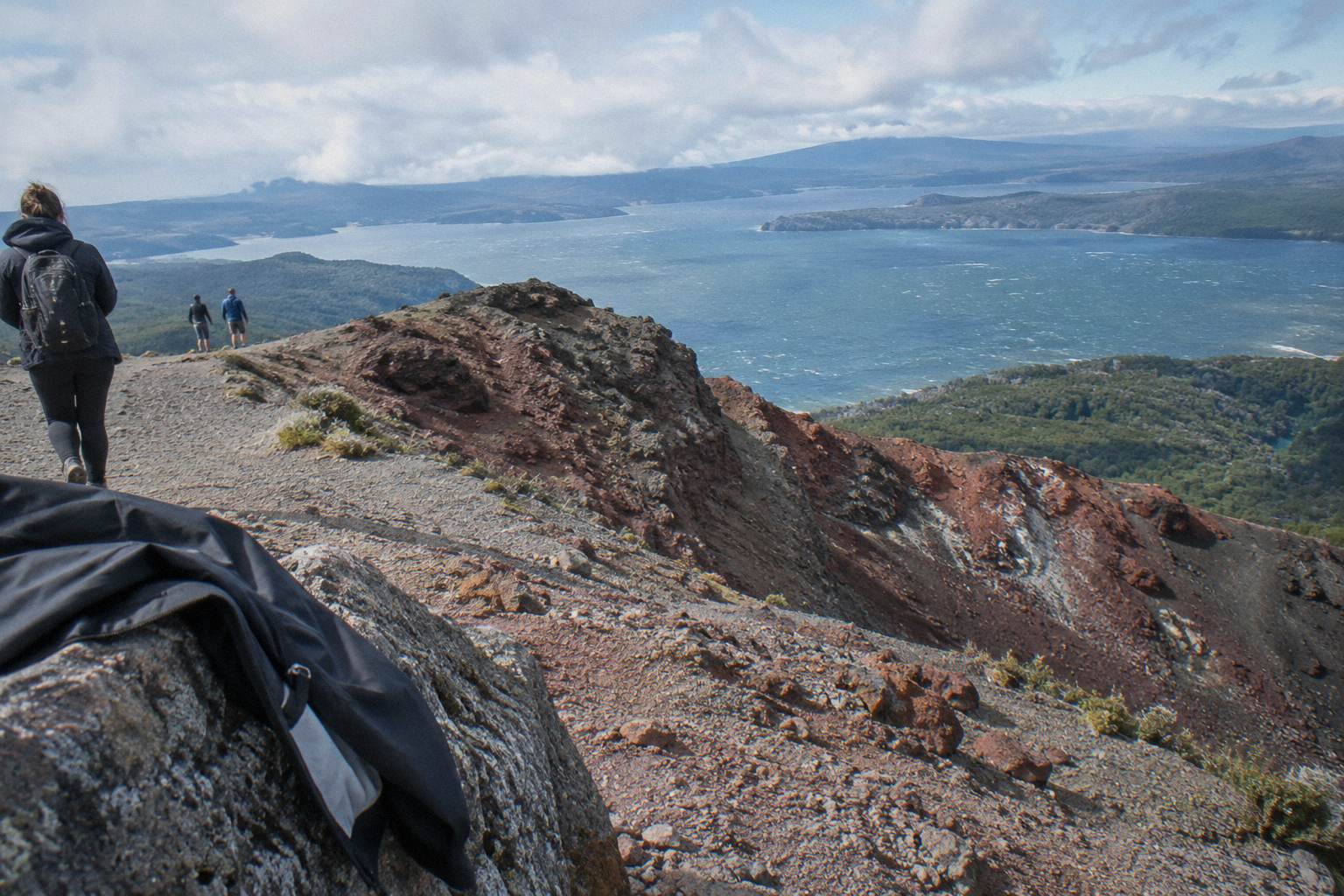
Two quieter points are worth flagging. Prices on this page are New Zealand dollars, and each from-price belongs to its own trip; there is no honest way to average them into a typical fare, so compare like trips instead. And check-in timing bites people: 30 minutes before departure for helicopters, 20 for floatplanes, at the Lakefront office, with no hotel pickup on standard flights. The flight length comparison guide is the companion read if timing is your constraint rather than scenery.
The choice of what to see is genuinely open, which is the appeal. A reader weighing all of it can start with Rotorua Helicopter Tours and work outward from the lake district to the rift to the island, or simply pick the one landscape that drew them to the region in the first place.
Common Questions About Rotorua Views From The Air
What Can You See On A Helicopter Flight Over Rotorua?
Crater lakes including Rotoiti, Okataina, Tarawera, Okareka, Rotomahana, Rotokakahi and Tikitapu; Mount Tarawera's summit domes and rift; the Waimangu Volcanic Valley; Orakei Korako on landing trips; and Whakaari / White Island on the longest routes, as a flyover only.
Can A Helicopter Land On Mount Tarawera?
Landing trips exist and land on the summit for a guided walk, but every landing is at the pilot's sole discretion and depends on weather, volcanic activity and aircraft loading. A landing is never guaranteed on any booking.
Which Lakes Does The 15-Minute Crater Lakes Flight Cross?
The operator's route names Rotoiti, Okataina, Tarawera, Okareka, Rotomahana, Rotokakahi (Green Lake) and Tikitapu (Blue Lake), and the route page also refers to views of 12 distinct crater lakes across the district.
Can You Still See Whakaari / White Island From A Flight?
Yes, from the air. Official New Zealand guidance says there are currently no boat tours to, or helicopter flights that land on, the island, so the island appears on itineraries as a flyover on the longest floatplane and helicopter routes.
Do The Flights Go Over The Pink And White Terraces?
The terraces were buried in the 1886 eruption. Flights cross Lake Rotomahana, where GNS notes remnants of the Pink Terraces may lie at the bottom of the lake; there is nothing visible to promise, only the lake basin itself.
What Happens If The Weather Blocks The Views?
All flights operate subject to suitable weather and safe flying conditions. If a flight cannot go ahead due to weather, the operator works with passengers to reschedule or provide a full refund.